
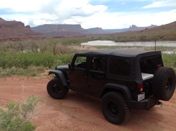
From Southern California, we took highway 15 north, passing thru Vegas only long enough for refueling. Making it into Utah on our first day, we stayed with friends overnight. The next day, we continued north to highway 70 that we took east, passing up the typical highway 191 southbound cut off and instead pushed onto highway 128. It takes a little longer to get to highway 128, but the payback is huge, given that you meander along the Colorado River and deep into the canyon. There is one of the best scenic drives in America. Highway 128 took us right to our next resting spot, the Red Cliffs Lodge, where we would stay for the week.
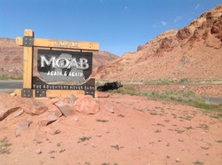
One and a half days of driving, we finally make it to Moab.
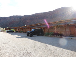
We stayed at the Red Cliffs Lodge (highly recommended) for our week long exploration. Red Cliffs Lodge provided an excellent home base for us to explore different areas of Moab each day. By the end of the week, we had developed our next year plan for some specific runs and how we will tent camp.
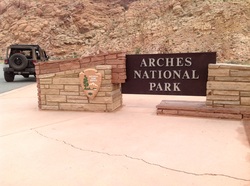
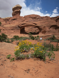
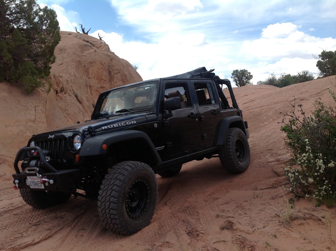
First day sightseeing in Arches National Park.
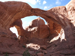
Incredible Arches.
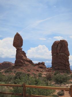
Famous "Balancing Rock"
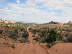
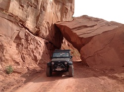
We cut out of the Arches "tourist loop" and explored this trail I had read about prior to our trip. The trail is moderate with one initial climb that is rough and requires high clearance. There are a few other off-camber and rocky sections to be careful of, plus eventual soft sand, overall, fun with the Jeep.
The trail ends at Tower Arch and provides complete isolation.
The trail ends at Tower Arch and provides complete isolation.
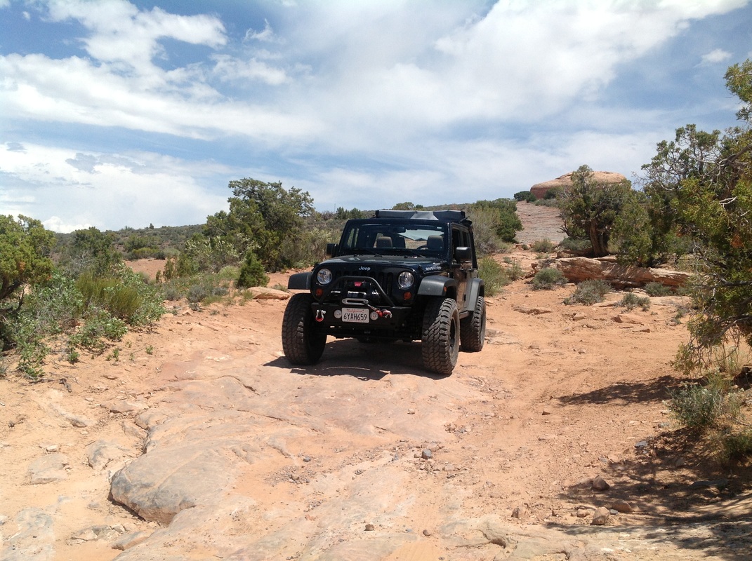
Eventually decided to air down to soften some of the bumps and keep us floating on top of the sand as it looked to get fairly soft.
Tower Arch is one of the less visited arches. To get here, you will need to four-wheel it, or hike in from a separate route; the hike is approximately two miles one way in the heat of the desert.
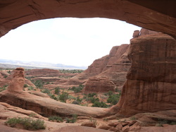
Epic views looking out from underneath the arch of Tower Arch.
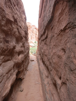
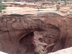
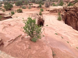
Hiking around at Tower Arch we found a mini slot canyon.
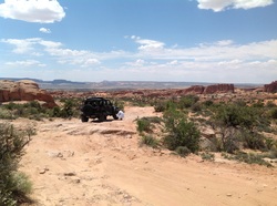
Leaving Tower Arch, there was another trail that that took us to another arch named "Eye of the Whale Arch". The sand here is dry and soft, but made for a cushy ride across the desert.
Taking a break along the trail on our way to Eye of the Whale Arch.
Arriving at Eye of the Whale Arch, we found ourselves all alone again. A short hike across the sand got us to the arch quickly.
From a distance, you can visualize "the whale" and the arch is the area below its tail.
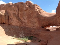
Further along our route, we arrived at this incredible double arch.
There is a separation in the middle, beyond the green plant, which makes this a double arch. This is one of the few arches you can actually walk across, and we did. Many years ago, this area was open to off-road vehicles and people would drive their Jeeps across these two arches. The area is now limited to only foot traffic.
On our second day, we explored Onion Creek to see what all the stink was about. Onion Creek gets its name from the sulfur that comes out of the earth and into the water, giving off a scent. The trail is move of a dirt road with many water crossings, some people count the water crossings, which is around 25 crossings. There is also camping along Onion Creek. The scenery is also quite spectacular deeper into the canyon.
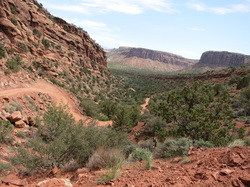
Further back into the canyon of Onion Creek, the trail ventures off into another longer trail that we did not have time to fully explore. The trail eventually gets a little more moderate and you need to be careful to watch the trail more than the scenery so as not to go off the edge.
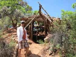
After cresting a hill, we made it back into a more wooded area to find this old forest cabin. There was not much left of it, but there is a box inside where you can log your name and home town, plus some other interesting items.
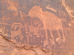
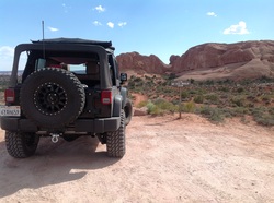
Finally found petroglyphs along the river on our way to Schafer Trail.
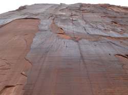
Looking straight up the granite rock wall.
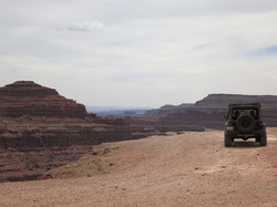
Thelma and Louise point. We understand that Grand Canyon National Park would not allow the Thelma and Louise car to be driven off the cliff for the movie scene and into the actual Grand Canyon, so this spot along Schafer Trail was used for the car launching. You can walk right to edge, with spectacular views of the canyons and Colorado River below.
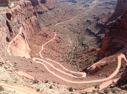
After making our way across Schafer Trail, we headed up the series of Schafer Trail switchbacks. The trail is well maintained. I recommend going up the trail as you will have the "right of way" in case of on coming traffic. However, not everyone knows this rule or obeys it. Keep an eye out for on-coming traffic and potential turn-outs which can make passing another vehicle much easier on this high shelf road.
After popping out at the top of Schafer Trail, we courteously paid our park fee as we exited and then found another trail that took us through "Fallen Rock".
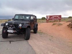
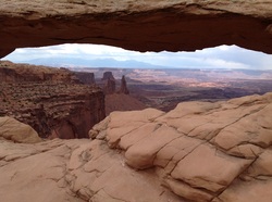
We also visited Canyonlands North and "Island in the Sky". Spectacular views and scenery, but not much four-wheeling in this part of the park.
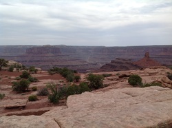
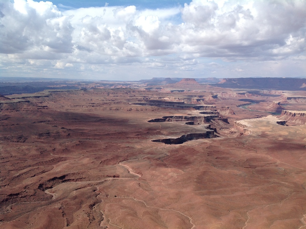
Looking out from the top layer of the plateau in Canyonlands, you can see Schafer Trail winding across the sandstone layer and the eventual clim up to the top layer.
The view from Island in the Sky is one of the best, you can view the sandstone layer below and also get a view of the White Rim Trail, which we plan to run on a future trip. And much further out in the distance is the convergence of the Green River and Colorado Rivers. Another trail we have on our "to-do" list is Elephant Hill, that comes in from the southern portion of Canyonlands and leads to an overlook view of the actual convergence of the rivers.
We were coming across arches in many places throughout Moab, including along the Canyonlands plateau.
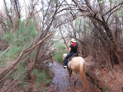
We also took time to explore around Red Cliffs lodge and took advantage of their horseback riding tour. An excellent tour of the area surrounding the lodge, as well as friendly and helpful cowboys and cowgirls to make your ride enjoyable. We finished our ride with a trot through a creek, headed back to the ranch.
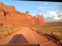
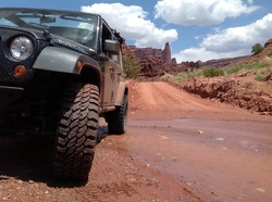
On our last full day in Moab, we headed up highway 128 for some general sight-seeing, exploring Castle Valley, and also getting up closer to Fisher Towers.
On our departure day, we decided to take the long way back to Southern California and drive past and into many of the other Utah parks including Capitol Reef, Escalante, Bryce Canyon, and Zion. We entered Zion from the north and enjoyed the initial views, but the magic really happens as you complete a two-minute drive through the mountain tunnel. At that point the sights become stunning.
Our farewell note (for now) to Moab
As I was zipping the three rear windows back into the Jeep tonight, I noticed the distinct contrast of clean vinyl windows against a very filthy Jeep (inside and out). Which reminded me of a saying my Mom said a long time ago, that went something like, "if you don't come home dirty, then you didn't have a good time". Well, by the amount of dirt, dust, and mud that is now ingrained into our Jeep, we have had an incredible time exploring Moab and the surrounding National Parks (Arches and Canyon Lands) in the state of Utah during this past week.
We have successfully visited many sights, Arches, bridges, canyons, parks, and more (including a visit to Eddie McStiff's on Main street in Moab for a beer in downtown Moab; thanks Rob for good beer guidance here) ...as we ventured far off the beaten path every day, we ended up in spots to be all alone in the beauty of the United States. In fact, for each of the last five days here in the Moab area, we found ourselves putting the Jeep into 4 Wheel drive to get to where we wanted to be and sometimes into 4 Low for rock crawling climbs and long steep declines, putting us in the middle of no where, but also in the middle of it all.
Along the way we have crossed paths with an incredible array of people, from family in Utah, to mountain bikers headed out into the wilderness of Thompson Canyon; we graciously refilled the three of them with ice cold water from the jugs in our cooler and wished them well on their journey. We also helped a guy get back to his feet after crashing his motorcycle on a rural road just moments before our arrival (which reminds me that I need a much more extensive first aid kit in the Jeep).
We will be heading out from the Red Cliffs Lodge (just outside of Moab, it's awesome, come here someday if you can) on Sunday; our route will not be defined until we are on the road, but with ambitions to visit Capital Reef, Bryce Canyon, and Zion (yes, ambitious). We will likely take all back roads to soak up as much scenery as possible along the way. So, stand by for one more "Jeep photo of the day", however, I won't be able to guarantee that the Jeep will be sitting in dirt (it's most favorite place of all; mine too), but there's a good chance we will have a rear window open or the top flipped open as we see the earth from as many points of view as possible.
I suspect we will eventually land on highway 15 at some point and arrive back in San Diego on Monday.
We have many awesome memories from this epic exploration of the Moab area, including the most amazing shooting star I can ever recall seeing, which Kathy claimed to be a meteor crashing to earth (when was the last time you saw a shooting star?).
In the meantime, turn off your TV (we did five years ago) and get out there. We are inspired to return to Moab soon with plans to run the White Rim trail with other Jeepers (it's an epic multi-day trip around the sandstone layer of the canyon); we will also plan to run Elephant Hill to see the awe inspiring coming together of the Green River and the Colorado River at Confluence Point (only reached by Jeep of course).
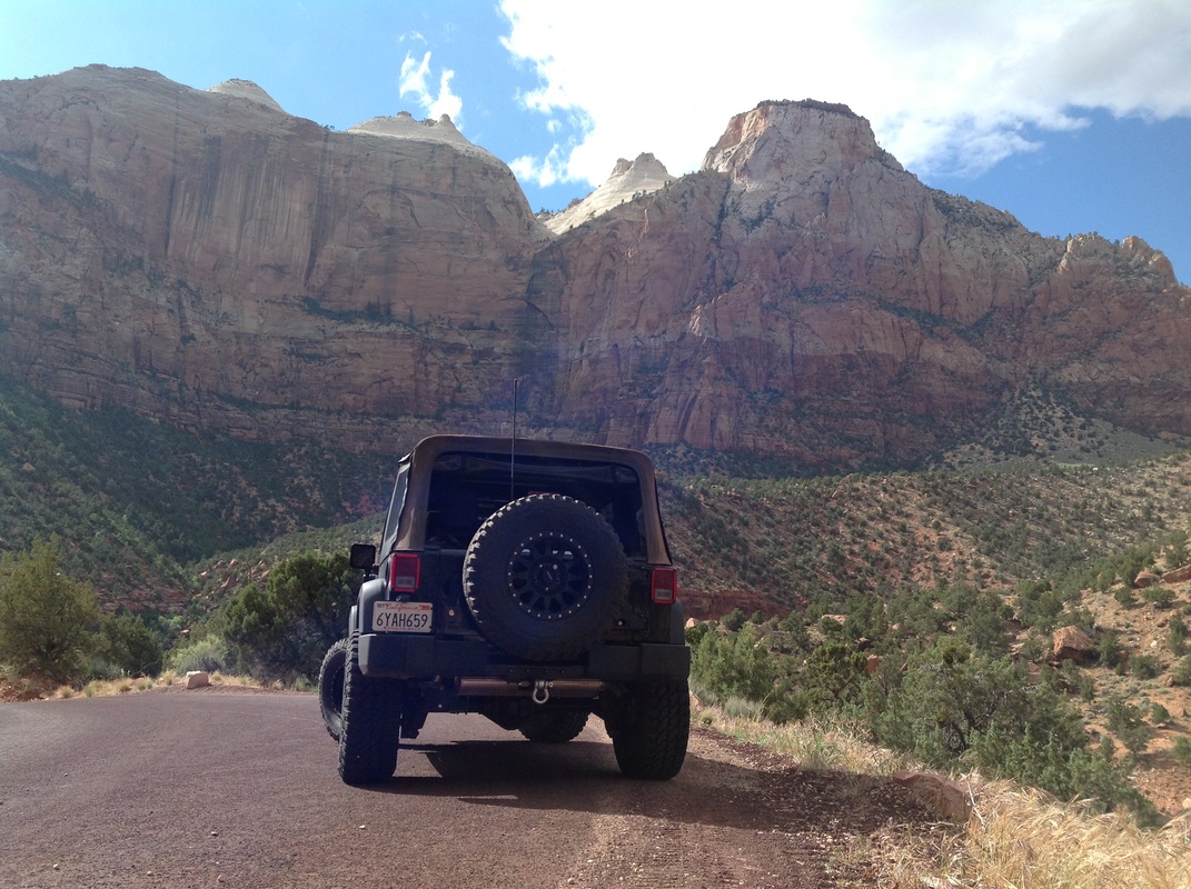
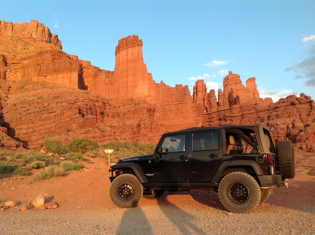
While earlier today we ran Gemini Bridges trail in the Jeep; an epic sight of two bridges that we walked across, I decided to share instead this simple sight of the Jeep at Fisher Towers (rock towers created by fissures) as the sun was going down today.
Until next time, keep all four on the floor and the shiny side up.
We have successfully visited many sights, Arches, bridges, canyons, parks, and more (including a visit to Eddie McStiff's on Main street in Moab for a beer in downtown Moab; thanks Rob for good beer guidance here) ...as we ventured far off the beaten path every day, we ended up in spots to be all alone in the beauty of the United States. In fact, for each of the last five days here in the Moab area, we found ourselves putting the Jeep into 4 Wheel drive to get to where we wanted to be and sometimes into 4 Low for rock crawling climbs and long steep declines, putting us in the middle of no where, but also in the middle of it all.
Along the way we have crossed paths with an incredible array of people, from family in Utah, to mountain bikers headed out into the wilderness of Thompson Canyon; we graciously refilled the three of them with ice cold water from the jugs in our cooler and wished them well on their journey. We also helped a guy get back to his feet after crashing his motorcycle on a rural road just moments before our arrival (which reminds me that I need a much more extensive first aid kit in the Jeep).
We will be heading out from the Red Cliffs Lodge (just outside of Moab, it's awesome, come here someday if you can) on Sunday; our route will not be defined until we are on the road, but with ambitions to visit Capital Reef, Bryce Canyon, and Zion (yes, ambitious). We will likely take all back roads to soak up as much scenery as possible along the way. So, stand by for one more "Jeep photo of the day", however, I won't be able to guarantee that the Jeep will be sitting in dirt (it's most favorite place of all; mine too), but there's a good chance we will have a rear window open or the top flipped open as we see the earth from as many points of view as possible.
I suspect we will eventually land on highway 15 at some point and arrive back in San Diego on Monday.
We have many awesome memories from this epic exploration of the Moab area, including the most amazing shooting star I can ever recall seeing, which Kathy claimed to be a meteor crashing to earth (when was the last time you saw a shooting star?).
In the meantime, turn off your TV (we did five years ago) and get out there. We are inspired to return to Moab soon with plans to run the White Rim trail with other Jeepers (it's an epic multi-day trip around the sandstone layer of the canyon); we will also plan to run Elephant Hill to see the awe inspiring coming together of the Green River and the Colorado River at Confluence Point (only reached by Jeep of course).
While earlier today we ran Gemini Bridges trail in the Jeep; an epic sight of two bridges that we walked across, I decided to share instead this simple sight of the Jeep at Fisher Towers (rock towers created by fissures) as the sun was going down today.
Until next time, keep all four on the floor and the shiny side up.


 RSS Feed