
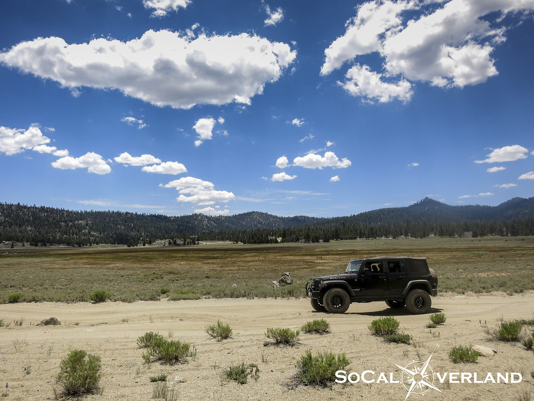
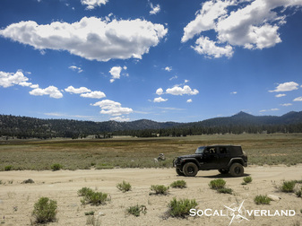
Arriving in the vast expanses of Monache Meadow at 8,000 feet elevation instills a humbling feeling that exemplifies our reason for escaping the confines of daily life.
Day two of camping in the Inyo National Forest
-Monache Trail detail
Day two of camping in the Inyo National Forest took us on the Monache Trail adventure. We expanded this days trail run by driving Jackass Meadow trail up to the Monache trail head.
Here is the Jackass Meadow trailhead off of Kennedy Meadows Road.
Here is the Jackass Meadow trailhead off of Kennedy Meadows Road.
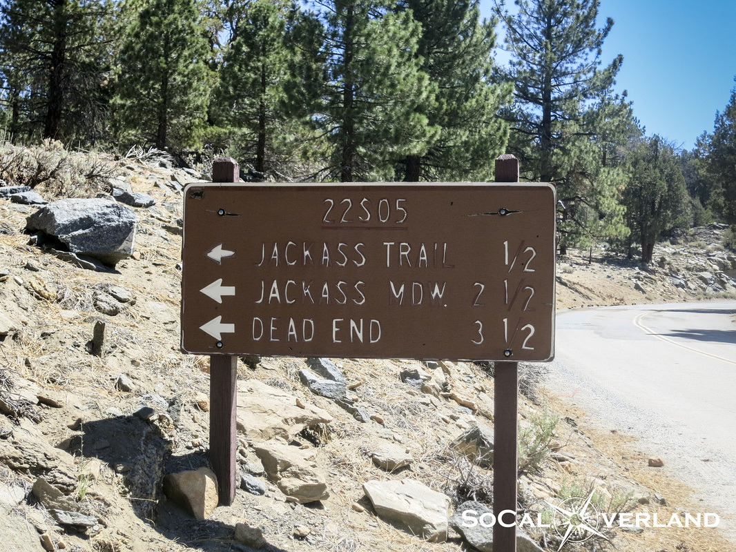
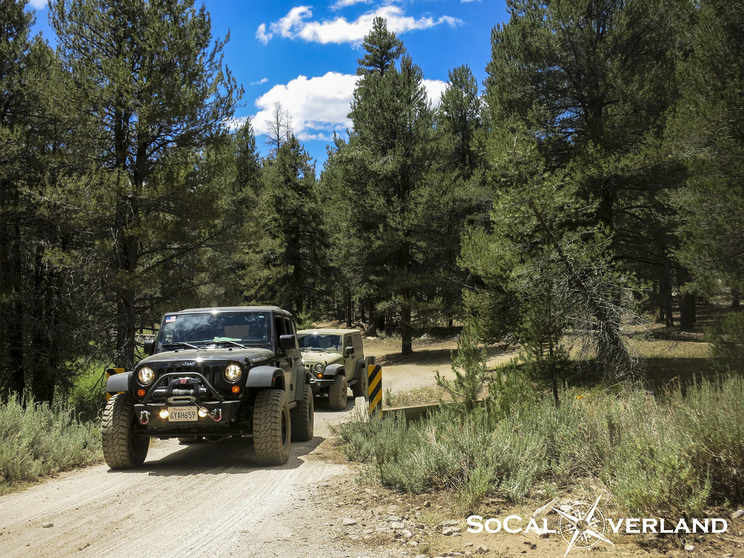
Taking the correct fork on Jackass Meadow trail leads up to Blackrock Road near Powell Meadow. Make sure you travel with a map and GPS to maintain your course and not get lost.
Do you know the correct fork to take here? Right? Left?
Do you know the correct fork to take here? Right? Left?
After exiting Jackass Trail and driving along Blackrock Road, there is a stunning view of Powell Meadow...just a teaser before making it to Monache.
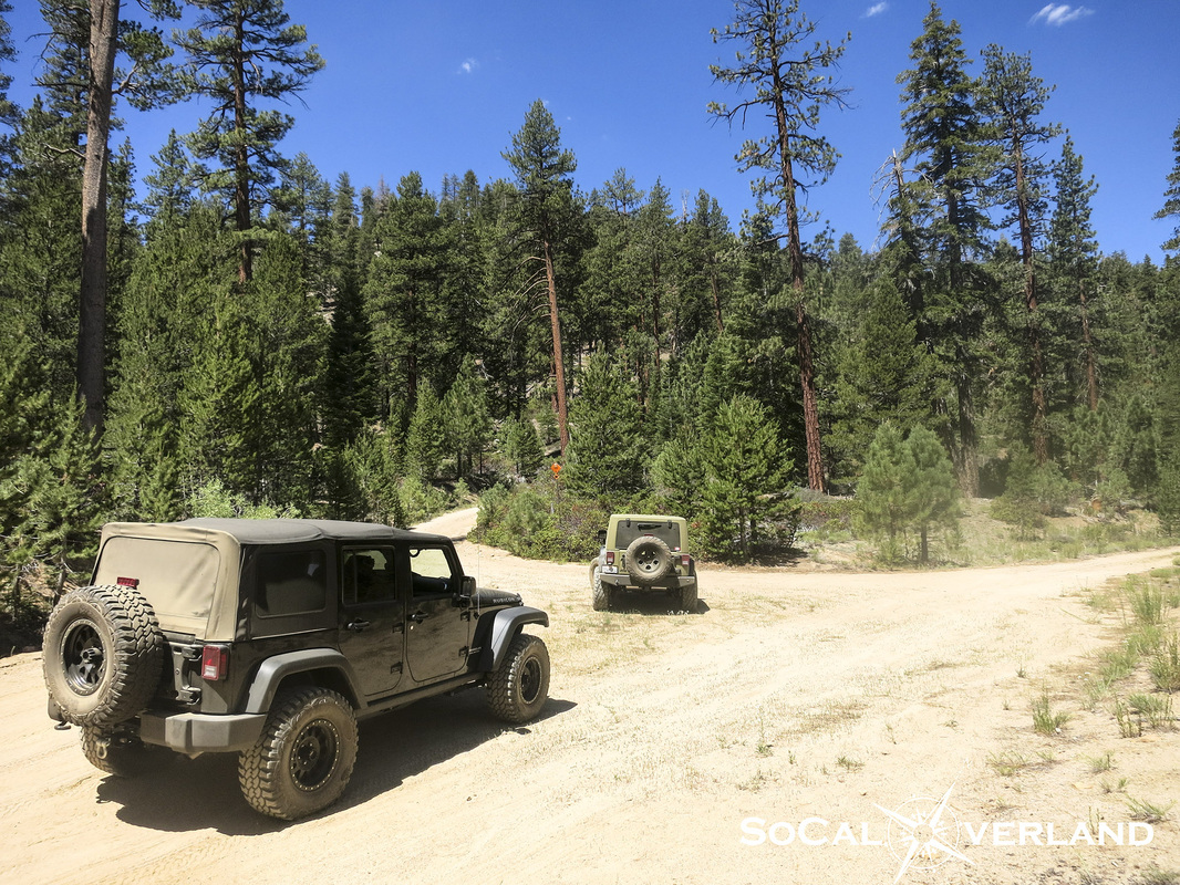
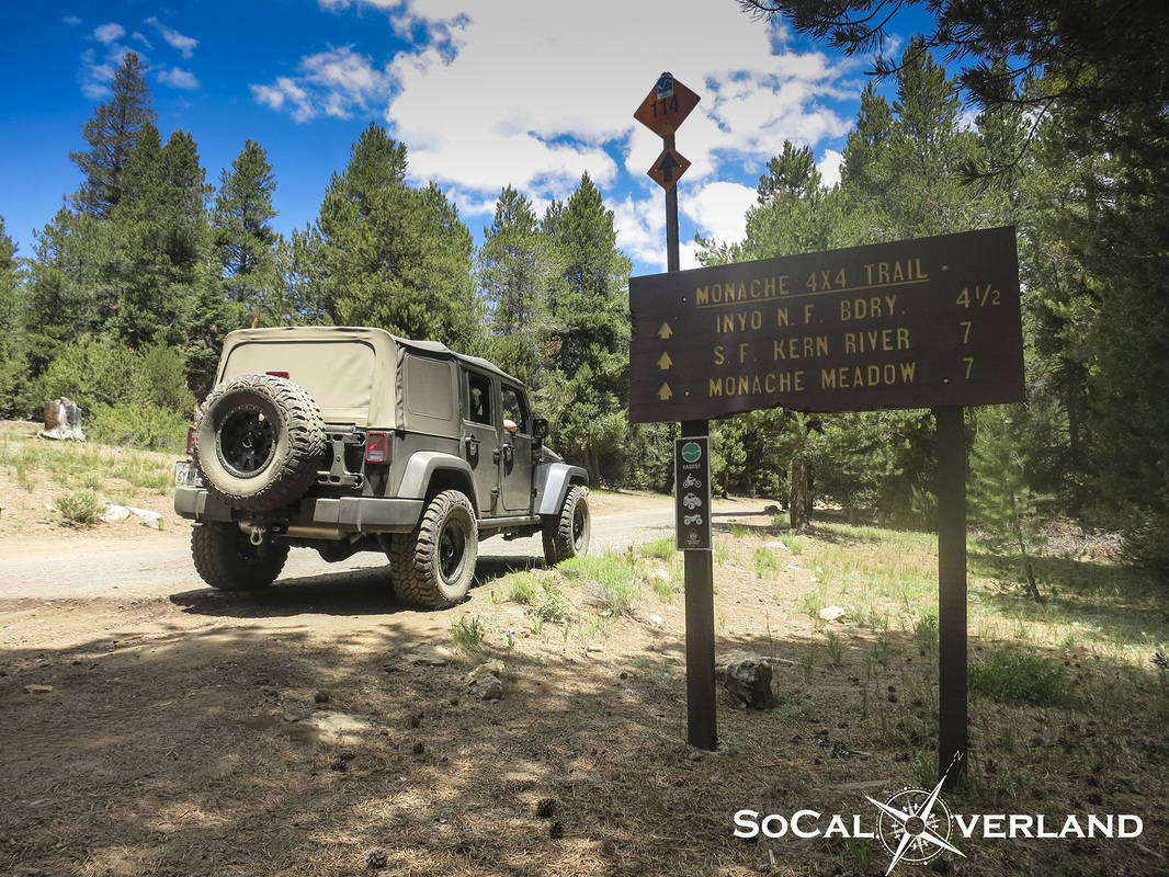
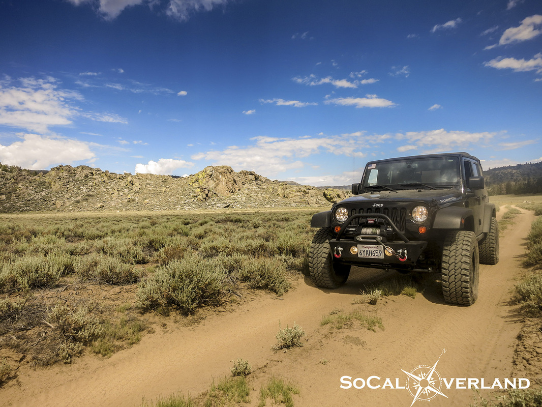
Entering Monache trail on the primary dirt road. The trail is approximately seven miles to Monache Meadow, plus another two miles to arrive at the primitive campsites.
Overall, the trail is easy and fun to drive. There is a moderate technical rock section at approximately 1.7 miles that requires four wheel drive and high clearance. Adding the additional two miles to arrive at the primitive campsites definitely requires four wheel drive (four low and a rear locker makes it easy) and high clearance is a necessity.
Overall, the trail is easy and fun to drive. There is a moderate technical rock section at approximately 1.7 miles that requires four wheel drive and high clearance. Adding the additional two miles to arrive at the primitive campsites definitely requires four wheel drive (four low and a rear locker makes it easy) and high clearance is a necessity.
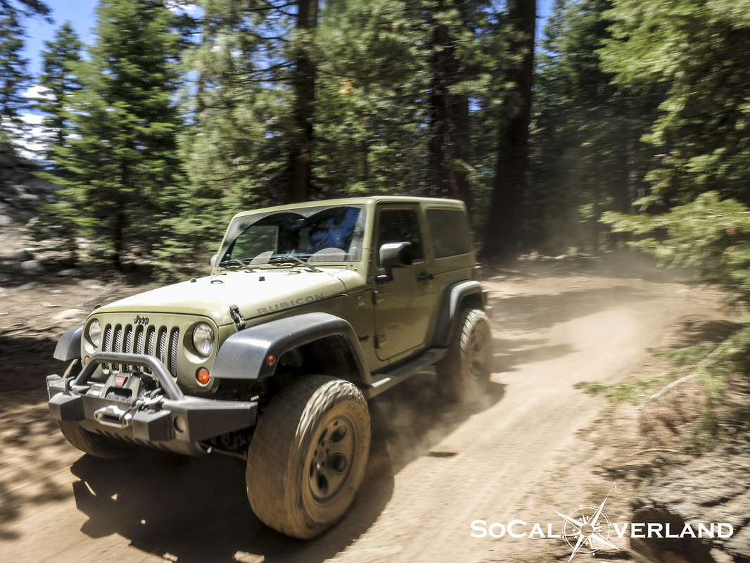
Here is El Chupacabra weaving between the trees and making easy work of Monache trail. I think El Chupo was inspired by our Johnny Cash music, which made this section seem extra fun.
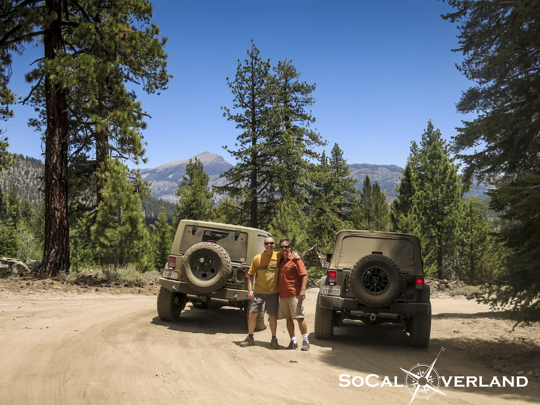
Taking a break along the trail to capture our rigs with Olancha peak in the background.
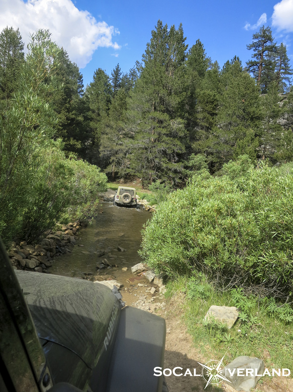
Crossing Snake Creek bridge at approximately 2.3 miles, prior to getting our first look at Monache Meadow.
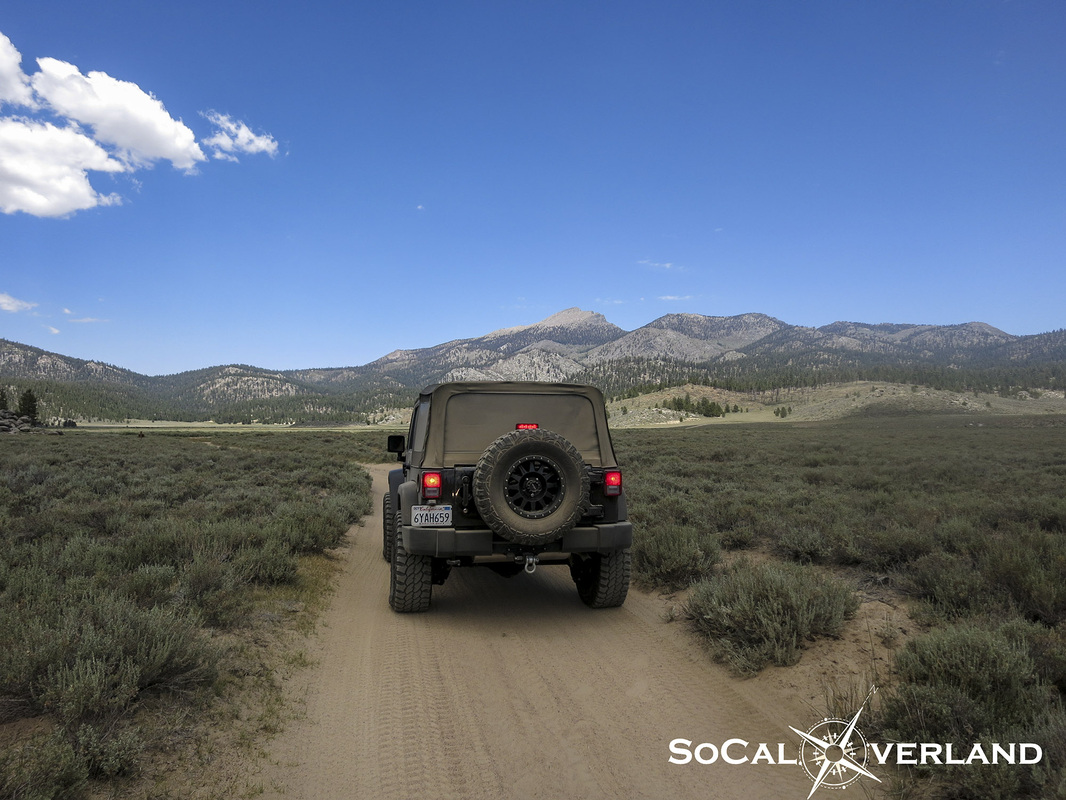
At about 2.5 miles we were greeted by the vastness of Monache Meadow. From this point, the trail continues through the meadow and includes a few whoop-di-doos.
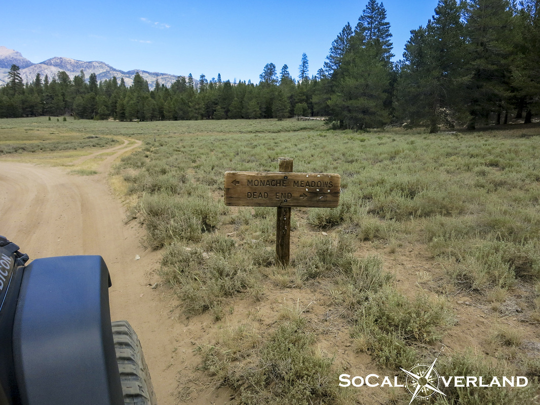
At about five miles, there is a fork in the trail. The dead end trail meanders down toward the Kern River. Because we were planning to meet our motorcycling friends, we decided to stay left and continue on to the first crossing of the Kern River.
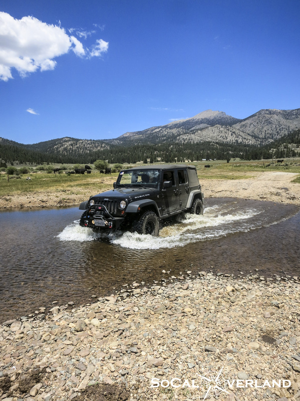
At approximately six miles is the first river crossing that leads to the other side of Monache Meadow, closer to Olivia's old ranch and a water spring.
Be sure to mind the boundaries and do not cross over any imaginary lines that are determined by marker posts. Doing so can get you a violation from the ranger or at a minimum a stern warning. Fortunately for us, we maintained on the trails at all times. Tread Lightly, remember?
Does this not look like a swamp monster coming up from the bottom of a lagoon full of cow pee?
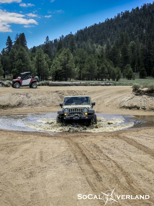
OK, it's just El Chupo exiting the first crossing of the Kern River...
Be sure to mind the boundaries and do not cross over any imaginary lines that are determined by marker posts. Doing so can get you a violation from the ranger or at a minimum a stern warning. Fortunately for us, we maintained on the trails at all times. Tread Lightly, remember?
Does this not look like a swamp monster coming up from the bottom of a lagoon full of cow pee?
OK, it's just El Chupo exiting the first crossing of the Kern River...
After forging the first water crossing, we stopped to take in a closer view of Olancha Peak.
Continuing on from this point, it is worth crossing the meadow and driving up to the abandoned structures of Olivia's, just make sure to look with your eyes and to not disturb the things that exist there today. The trail up to Olivia's is approximately one mile and ends in a turn-around to exit the way you entered.
Continuing on from this point, it is worth crossing the meadow and driving up to the abandoned structures of Olivia's, just make sure to look with your eyes and to not disturb the things that exist there today. The trail up to Olivia's is approximately one mile and ends in a turn-around to exit the way you entered.
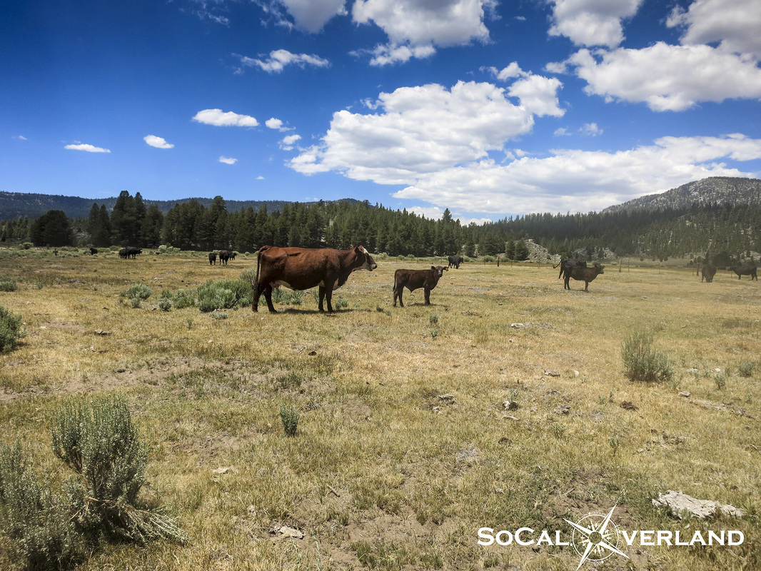
The real cowboys were supposed to be "driving cattle" this weekend. We were hoping our timing was right so the kids could take in the sights of cowboys in action, but this day we were not so lucky.
Though we did get to see lots of cows roaming the open fields.
Though we did get to see lots of cows roaming the open fields.
Forging the Kern River a second time before taking a mid-day break for lunch and waiting around for our motorcycle friends to arrive.
The kids had a lot of fun exploring the Kern River and searching out fish in the deeper sections. Fortunately no kids fell in the water this day. Just be careful to not step in a fresh cow pie...
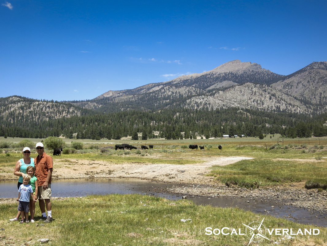
Our family photo in Monache Meadow with Olancha Peak in the background.
Our family photo in Monache Meadow with Olancha Peak in the background.
We brought our Big Agnes shade to provide some protection from the sun and wind while we enjoyed lunch and continued our wait for our motorcycling friends to arrive. Aren't motorcycles supposed to be faster on the trail than Jeeps? We waited and waited...
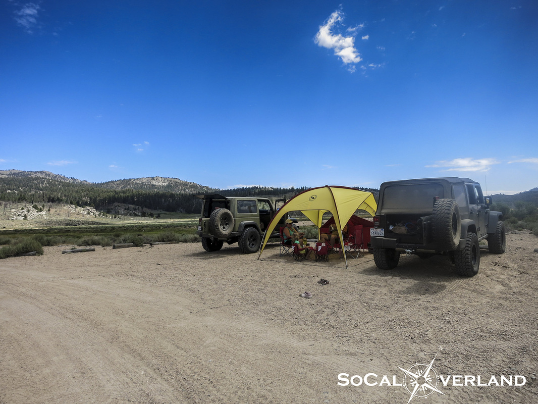
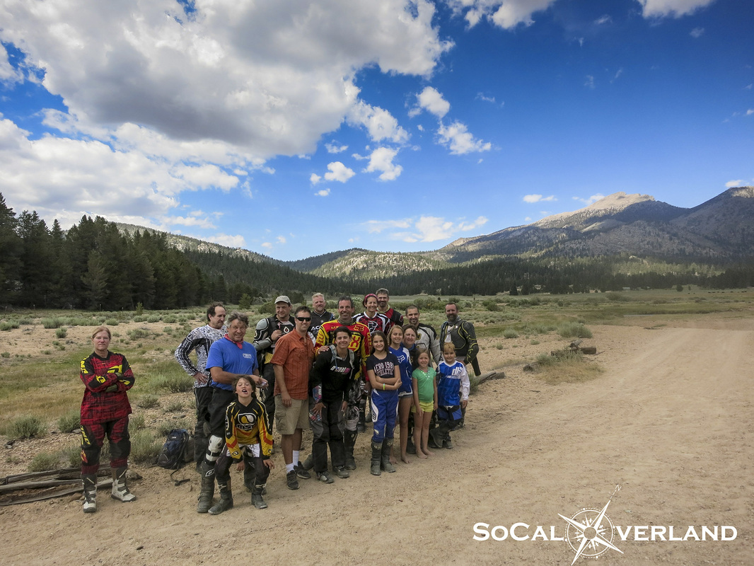
Just as we were getting ready to eat everyone's lunch, the group arrived.
Here I am jumping in with many long-time moto friends for a group photo. Next year I too may be doing this run on a motorcycle. No, seriously.
Here I am jumping in with many long-time moto friends for a group photo. Next year I too may be doing this run on a motorcycle. No, seriously.
After our late afternoon lunch and visiting with friends, we explored out to the edge of Inyo National Forest to reach the South Sierra Wilderness. Travel into the South Sierra Wilderness is restricted, so we stopped at the gate and turned around.
From Monache Meadow, we explored Bake Oven and the Monache Meadows "sand dune". Our final destination was the end of the trail and primitive camping sites where we had originally planned to camp, except for the restrictions on campfires during this dry summer, which had changed our ultimate choice of a camping location.
The final section of trail, which is completely optional, is moderate and requires four wheel drive and high clearance. The Kern River crossing is deeper and longer in this section, but not a problem for the Jeeps.
The final section of trail, which is completely optional, is moderate and requires four wheel drive and high clearance. The Kern River crossing is deeper and longer in this section, but not a problem for the Jeeps.
We exited Monache trail using the same route that we entered.
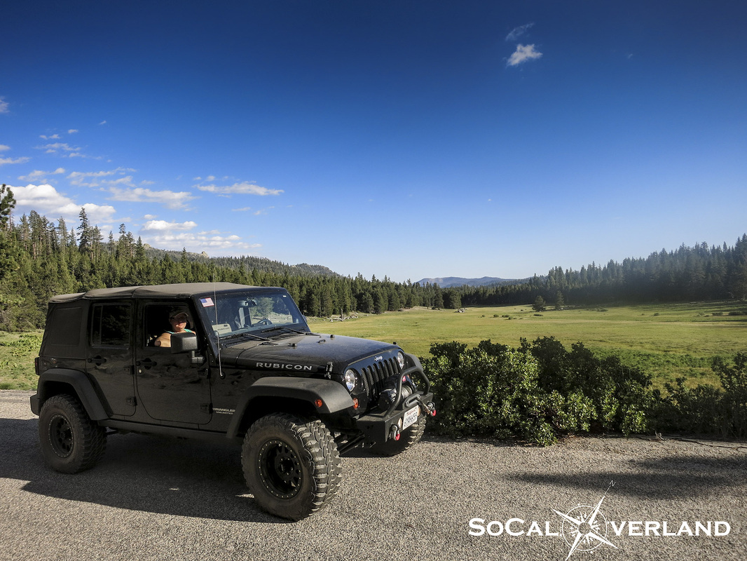
Because dinner time was approaching and the kids had fallen asleep in the back seat (they slept even while we were wheeling on Monache trail), we decided to drive Blackrock Road down to Sherman Pass and back to camp.
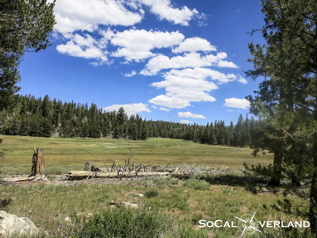
Passing by Smith Meadow, it was impossible to not to stop and photograph this lush landscape.
Because dinner time was approaching and the kids had fallen asleep in the back seat (they slept even while we were wheeling on Monache trail), we decided to drive Blackrock Road down to Sherman Pass and back to camp.
Passing by Smith Meadow, it was impossible to not to stop and photograph this lush landscape.
Have you ever run Monache Trail? If not, we hope you enjoyed reading about our adventure. Maybe you will join us next time!
Thanks again to Robin Reid for editing our pictures.
Thanks again to Robin Reid for editing our pictures.

 RSS Feed